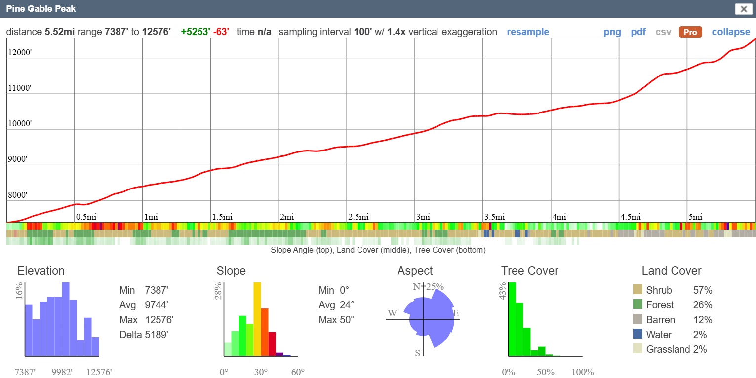
Mon. Jul 27 (6a start)
RT Distance: 11 miles
Elev. Gain: 5,300 ft.
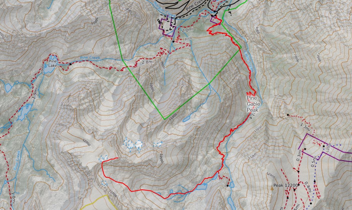
Pine Gable Peak is an very unofficially named peak that lies on the border of Inyo National Forest and John Muir Wilderness. I say very unofficially because it was named by yours truly, and I chose this name because it lies between the Pine and Gable Creek Drainages. The recent lidar survey has "discovered" that this point is a p300, which has motivated me to put it on this year's challenge. From Pine Creek Pass Trailhead, follow the Gable Creek Trail south towards Gable Lakes. Follow the watercourse towards its source, then climb the moraine, looking for a weakness in the cliffs above to reach the ridge.
Other Challenge peaks in this area include Peak of the Four Winds, Gable Lakes Peak or Hanging Valley Peak. Bonus peaks might include Peak 12,601, Treasure Benchmark, among many others.
6am start from the unmaintained Gable Creek Trailhead.